
The Klamath mountains area of Oregon is the south western most corner of our state. The Klamaths are made up of a group of large metamorphic and igneous rocks that formed out in the ocean and then accreted with the North American plate about 150 mya (million years ago). The area is made up of intrusive igneous deposits like diorite and granodiorite. These layers happened on top of marine and continental layers.
The Klamaths are home to a large number of valuable mineral deposits. Examples include Gold and silver, as well as zinc, lead and chromium. A lot of gold was chased after during the 18th and 19th century, which hydraulic mining being used to great success. One major geologic feature of this area is the Oregon Caves National Monument as pictured here. It is made up entirely of marble, and has a handful of cool geologic features like large stalagtites and pillars that took thousands of years to form. 
 Oregon is home to a large portion of the cascade range of mountains. The two most notable is Mt. Hood and Mt. St Helens ( St. Helens is technically in Washington), both of which are visible on a clear day from Portland. Mt. Hood is an extremely popular destination for winter sports enthusiasts. The glacier there is accessible all year round, which means skiing even in the summer.
The other major mountain is Mt. Saint Helens. In 1980 a major eruption took place here. Large amounts of ash was thrown into the air, some of which traveled as far as Japan. The explosion from the eruption was so violent it drastically changed the ecosystem of the mountain. Spirit lake was completely filled in with trees and debris. The blast blew away virtually all things in its path for a 17 mile area in a fan shape from the epicenter(Carson 39)
Other notable Oregon Cascadian mountains include Mt. Jefferson, Mt. Washington, MT bachelor and Three sisters.(pictured above) The range extends from northern California all the way up into British Colombia, but Portlanders are familiar with our two favorite mountains on our doorstep.
If you are naive to the area, or simply a curious out-of-towner, make sure to visit the museum on Mt. St. Helens, because it has a large bevy of information, as well as a cool movie theater and lots of samples and engaging picture exhibits from when the blast happened.
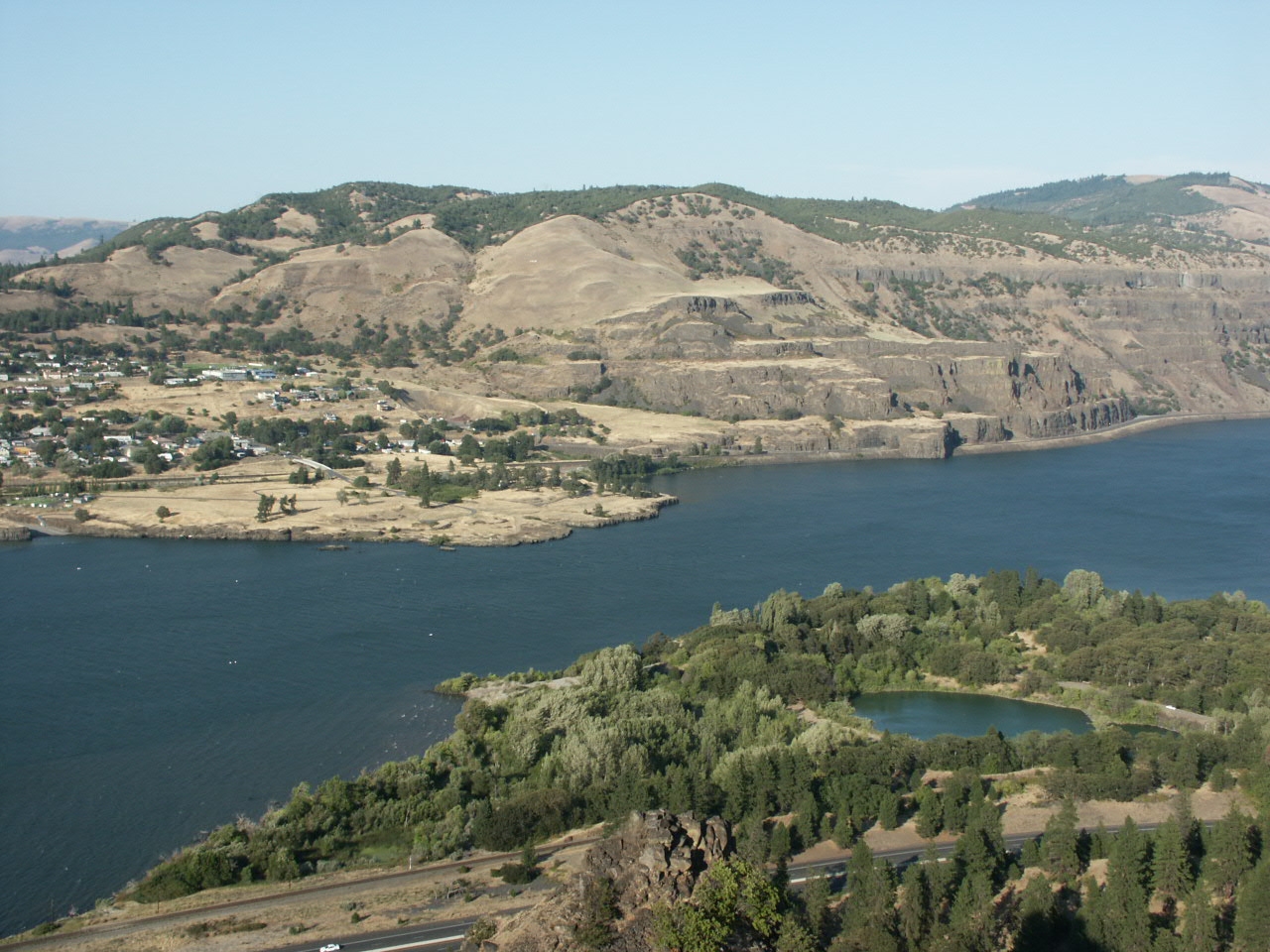 The Colombia gorge is a geological area due Northwest of Portland. As you drive along I-84 East you drive through a large portion of it. The area features a plethora of interesting geological formations and stories.
An important thing to note is how the weather of the Gorge typically differs from the valley of Portland. The Coast range and the Cascade range create a 'rainshadow'. This effect means that less moisture falls in the Colombia gorge area because the moisture is impeded from crossing over the mountain ranges. But believe it or not, a long time ago this area was full of different species found in subtropical areas. The evidence for this is found in fossils from around the Tertiary period which is about 6-17 million years ago.
The gorge is a very popular for outdoor activities including wind surfing, camping, hiking and fishing. But the landscape is not untouched. There are many dams in the Colombia plateau, most of which were built in the 1930s, 40's and 50's. There are arguments for and against the dams. Salmon populations are a very hot issue of contention in this area.
The hills of West Portland are pa rt of a rich tapestry of geologic history that can be found with just a little digging. The area lies on top of the Portland hills silt. The Portland hills silt was the layer formed during a glacial period. sediment called loess (which is wind-blown sediment) was built up on top of other layers.
An interesting sidebar about Portland Hills: there area a number of faults near the hills like the "zoo" fault and the Washington park fault. Geologists can tell these are places where there was faulting or folding because of changes in the nearby rock layers. These are clearly visible when you are in the Zoo max tunnel where there are clear samples of the different layers of rock.
Another interesting geologic feature of Portland is called the Boring lava floes. There is about 90 formations/vents within a 20 mile radius of Troutdale. They are small cinder and shield volcanoes. Many of them are now features of everyday Portland life such as Mount tabor where there are basketball courts and other attractions.
There are a few locations where the formations have been eroded and you can see the actually layers. such a location can be seen on the I-205 freeway. The large scale Missoula floods were the mechanism for the erosion.
Wouldn't it be a fun challenge to visit every one of the 90 formations in Portland?